


Have a kochia problem? Save thousands of dollars by using SWAT MAPS and SWAT CAM to VR residual herbicides
Thursday, October 12, 2023 8:40 AM
Reading Time: 3 minutes
SWAT MAPS and SWAT CAM have proven to be useful tools for reducing weed populations not only across the field, but also in specific management zones. Kochia is an example of a weed that can be targeted using VR spray prescriptions to limit applications of expensive residual herbicides, therefore providing savings of thousands of dollars by not blanket applying the product on every acre.
Prevalence of Kochia
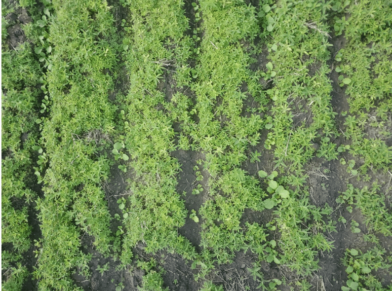
Kochia is a problem weed across the Canadian prairies and US great plains. It thrives in salinity and areas with less crop competition (Figure 1). Kochia establishes itself very quickly in these areas and is a prolific seed producer (15,000-25,000 seeds per plant).
Herbicide resistance is a major problem in controlling kochia. Kochia resistance to Groups 2,4,9, and most recently Group 14 herbicides has been confirmed. Using residual herbicides has been an effective way to help reduce kochia populations that emerge in-crop. Residual herbicides are expensive, therefore, if we can limit our applications of these products only to the areas of the fields where kochia is growing, it will be more cost effective.
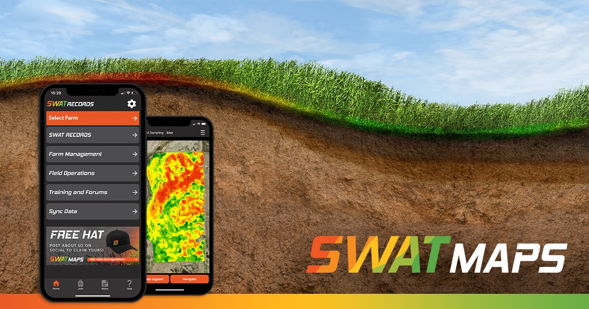
Using SWAT MAPS to VR Apply Granular Herbicide and Sulphur
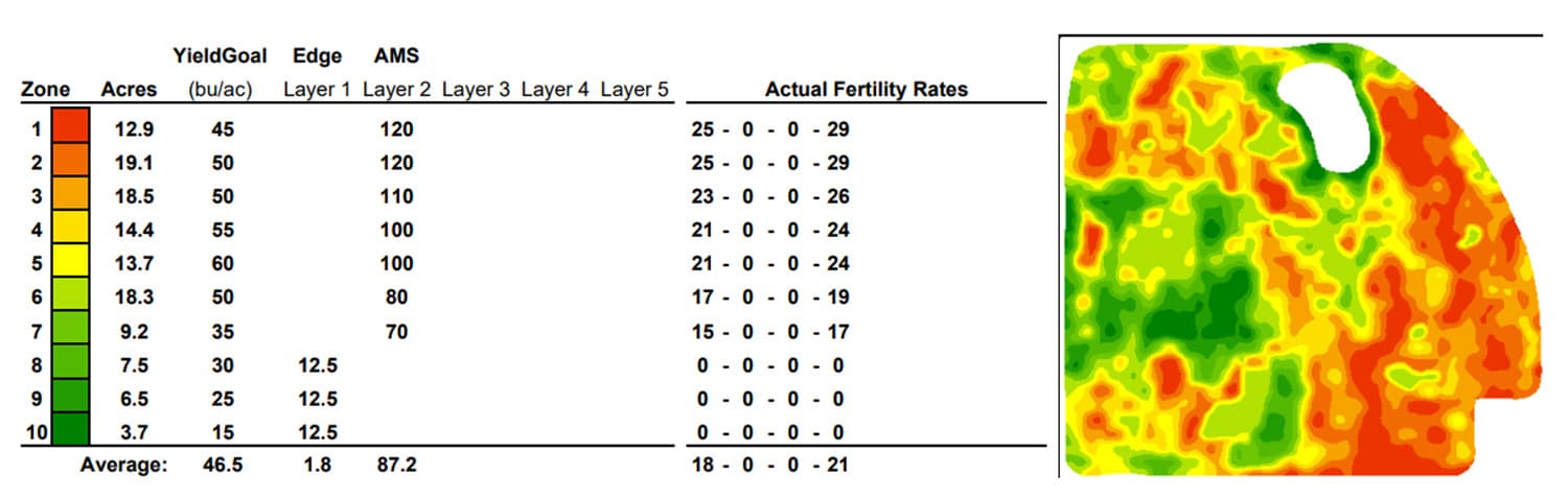
Since kochia is most prevalent in saline areas of the field, we can use SWAT MAPS to delineate where these saline areas are and manage them. We can use this data and only apply residual herbicides in the areas where kochia is growing. This strategy would need to be ground-truthed to confirm that there is kochia growing in these management zones. Some of the products that we may use are Edge (ethalfluralin) prior to canola, or Authority (sulfentrazone) prior to sowing wheat or peas. In Figure 2, we are applying both variable rate (VR) Edge and sulphur with an air boom applicator that has two separate tanks, using SWAT MAPS as our map source. The average rate in this example is 1.8 lbs/ac. We are applying Edge on just 14% of the field, which works out to a cost savings of $3200 on this 124 acre field.
Using SWAT CAM to Develop On/Off Herbicide Spray Prescriptions
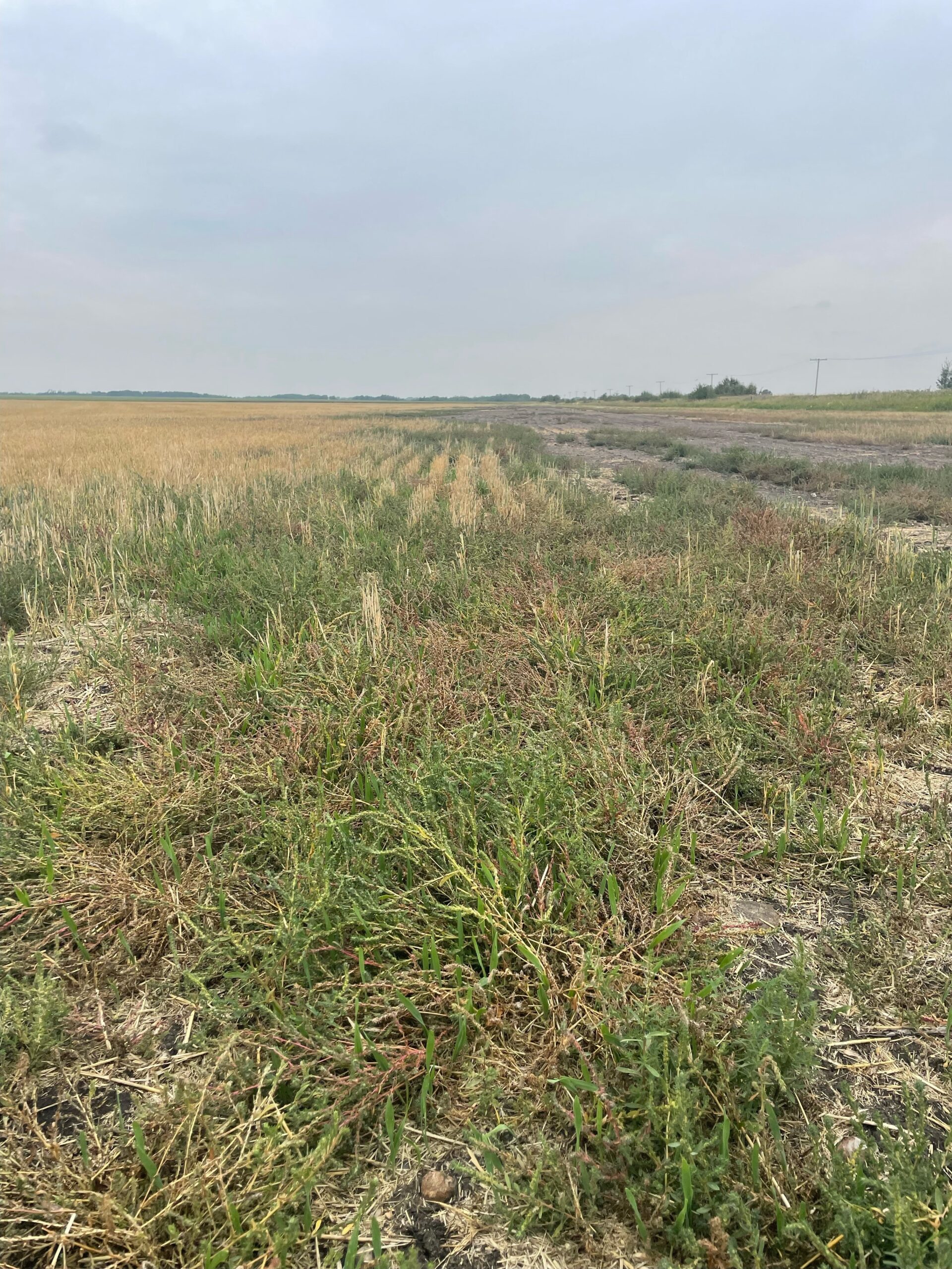
SWAT CAM is an automated camera system mounted to a sprayer boom that captures images throughout the field. These images are then run through a machine learning model and can quantify weeds and crop separately. One of the models that is available is a kochia model, which allows us to create kochia maps on a field (Figure 3). We can view individual pictures taken across a field as represented by the black dots in Figure 3. Figure 4 demonstrates a photo from one of those dots, where you can see the kochia pressure in that spot. We can then use this map to develop an on/off herbicide prescription that can be applied to the field.
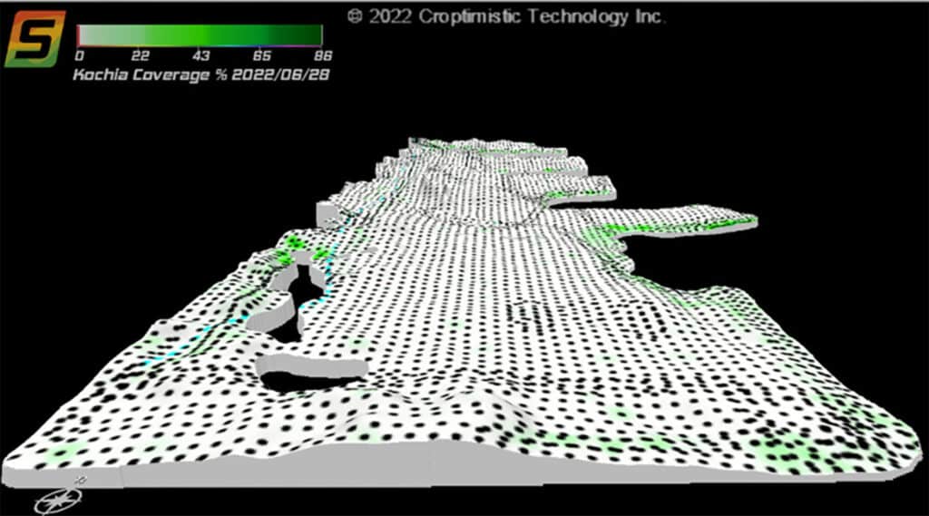
In the field in Figure 3, if we apply Authority in only the areas with kochia growing, we would save approximately $9500 compared to blanket applying the herbicide on every acre. This cost savings also increases the likelihood that a grower would apply a residual herbicide utilizing a multiple mode of action layering strategy to control the weed.
SWAT MAPS and SWAT CAM can be very useful tools in managing kochia in a cost-effective way by only targeting the areas of the field where kochia is present. Using data form SWAT MAPS and SWAT CAM, we can create variable rate or on/off prescriptions for applying many different pre-emergent herbicides for sprayers or air-boom applicators. Ground truthing is still necessary before using maps to apply VR herbicides. For more information on SWAT MAPS, SWAT CAM, or the value they can provide your operation, please find your local SWAT MAPS Service Provider or contact us.
Brandon Smith
Senior Precision Agronomist
Become a SWAT News insider!
Sign Me Up!
Join Our Mailing List
Enter your email below to sign up for our mailing list.
We care about the protection of your data. We’ll never share your details.
Croptimistic Technology Inc. is an international agriculture technology (AgTech) company. We began operating in 2018. Croptimistic is supported by a growing team of professionals who have dedicated their careers to developing the best soil mapping software and hardware in the world.
Copyright Croptimistic Technology Inc. © 2024 All Rights Reserved.
Privacy Policy
