


Soil Potential
Everything starts in the soil. By becoming a SWAT MAPS service provider, we will help you execute the process to help your farmers unlock their soil potential today.
Book A Demo
Not sure where to start? Reach out to our team directly and we'll help get the ball rolling.
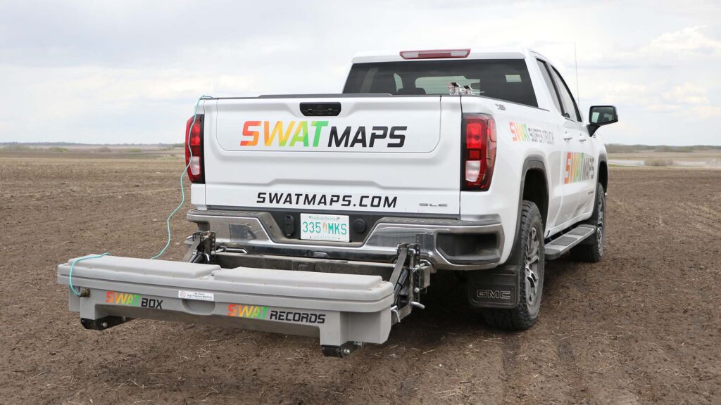
1SWAT BOX & Data Collection
Our patented SWAT BOX was created to make soil mapping as easy as possible. Simply mount it to your truck, ATV, or a variety of farm equipment, connect it to SWAT RECORDS and you’re ready to drive the field. The SWAT BOX collects the necessary data to create your farmer’s SWAT MAPS. It’s a crucial step in the process and we offer training in SWAT ACADEMY for setting it up and mapping to generate accurate data.
Learn about using the SWAT SUPER TRUCK to collect your data
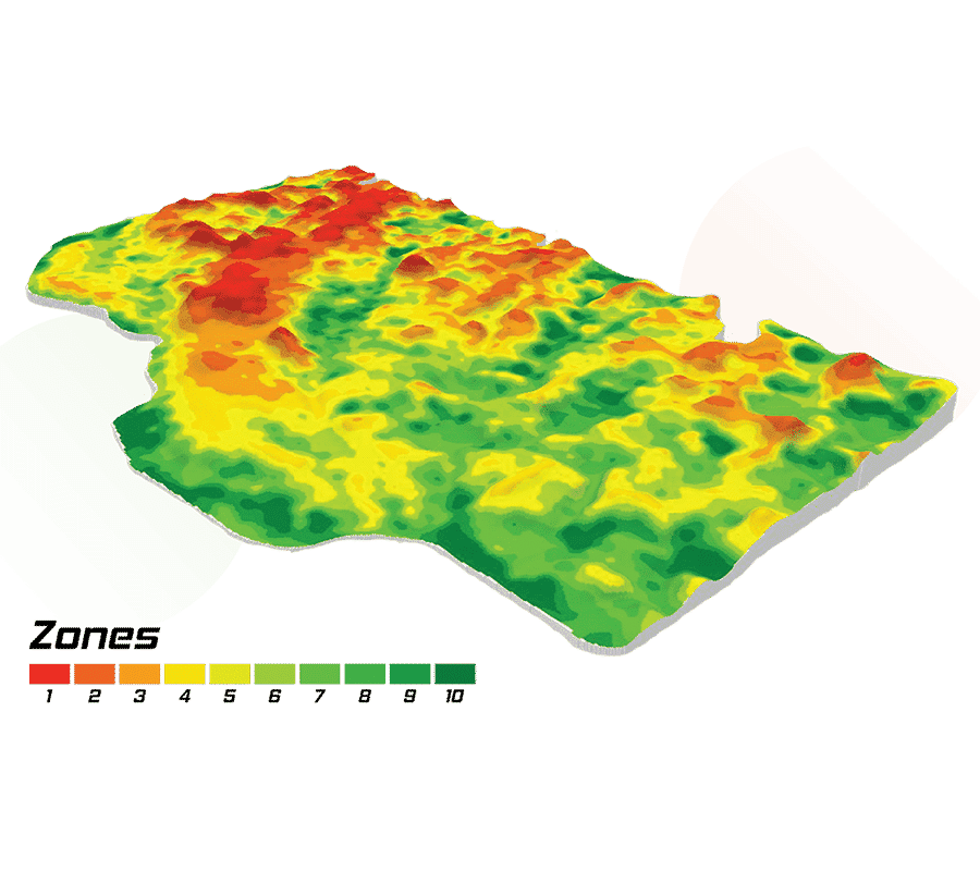
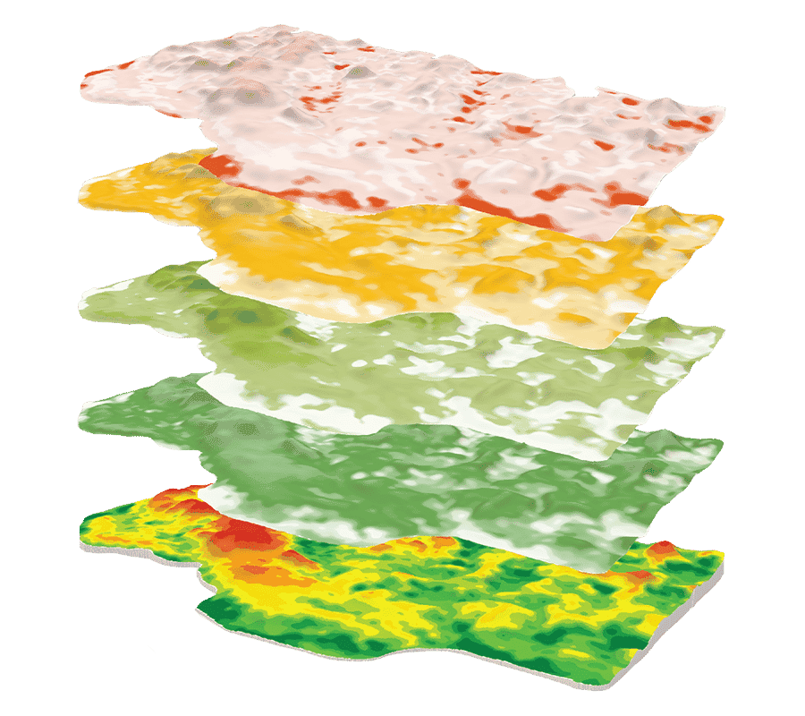
2SWAT MAPS
Now that the raw data has been collected using your SWAT BOX and uploaded to SWAT RECORDS it’s ready for our team of experts to process and turn into SWAT MAPS. Multiple options will be created and added to SWAT RECORDS.
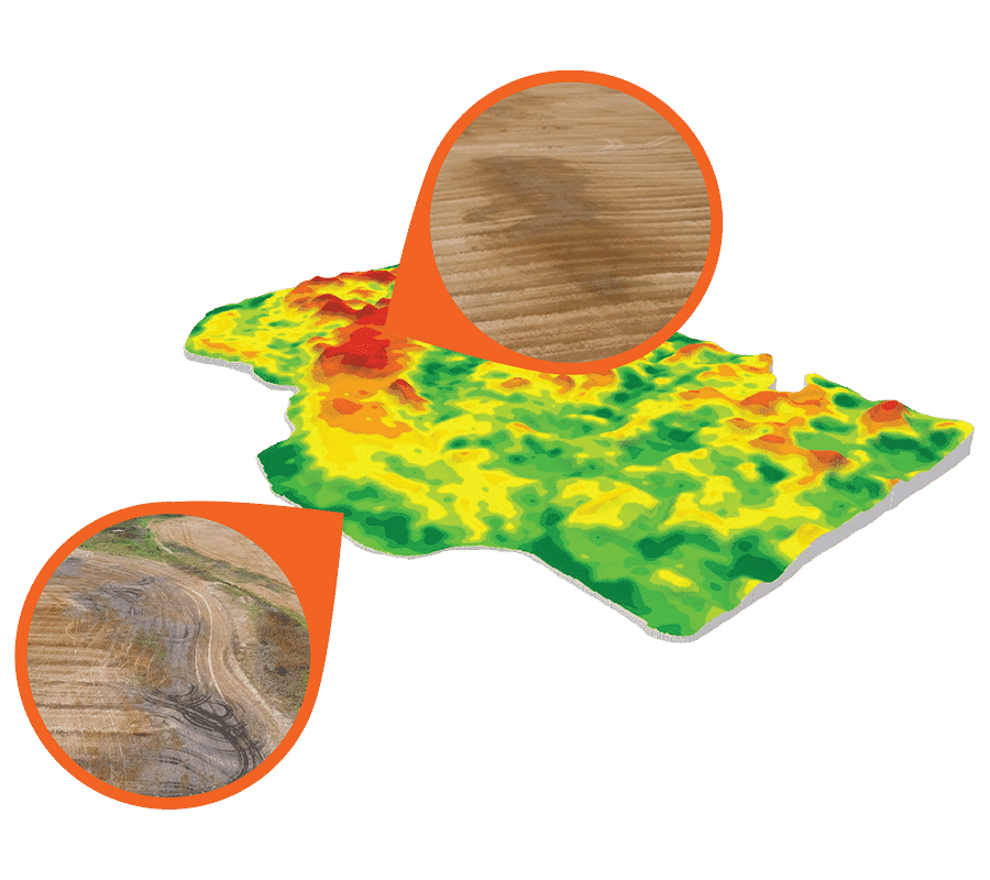
3Ground Truthing
You’ll ground-truth the created SWAT MAPS and select the one that best represents your farmer’s field. It’s an essential step in the process as it ensures your SWAT MAPS accurately depict soil and water variability.
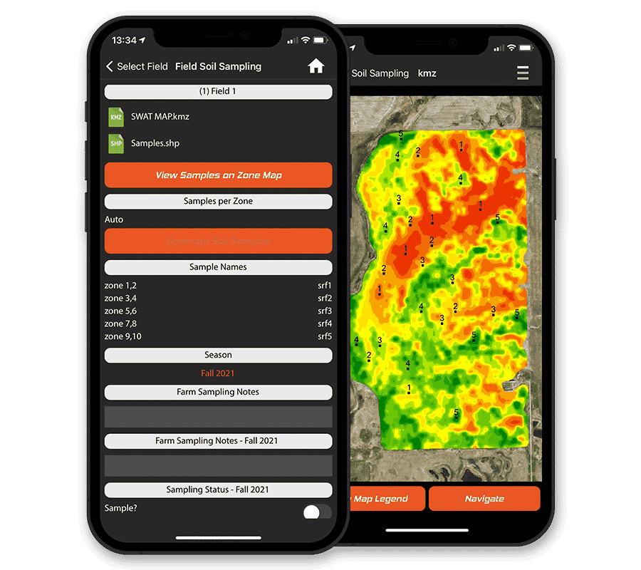
4Soil Sampling
Now that you’ve ground-truthed the SWAT MAP, it’s time to soil sample the field. Typically, 5 out of 10 SWAT zones are sampled, depending on field size, your end goal, and the cost versus benefit of sampling intensity. The number of samples taken per zone is defined by you, but we suggest sampling from three to six points within each zone. We currently have a number of labs that can automatically upload results to SWAT RECORDS, with more labs being added regularly.
5Soil Prescriptions
Next, you’ll create variable rate prescriptions for seed, fertilizer, or soil-applied herbicides based on soil test results and SWAT zones. This step turns data into actionable value. Your recommendations will be added to SWAT RECORDS as new ‘jobs’ for your farmers to execute.
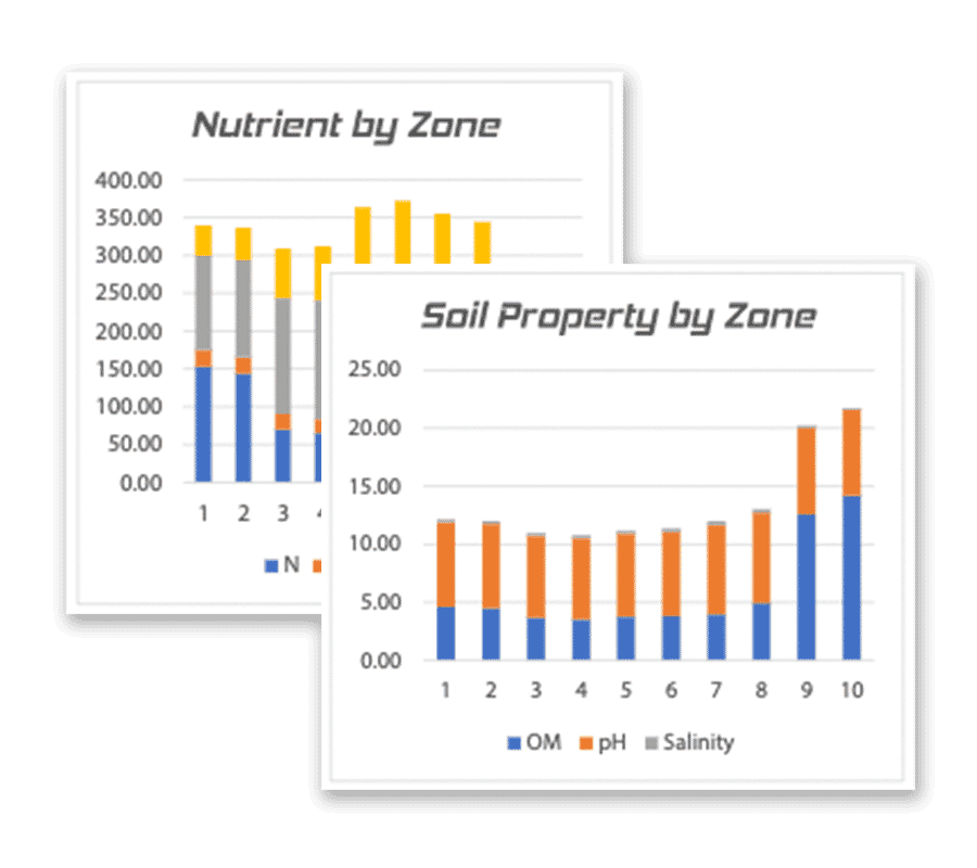
6Soil Analytics
The last step in the soil potential process is to analyze nutrient, texture, and soil carbon data. Soil data can be connected to soil survey databases to assess varietal or hybrid crop response to nutrients based on soil type.
Ready to Unlock Your Soil Potential?
Become the local precision agronomy expert by providing the only all-in-one variable rate solution to your farmers.
Book A Demo
Dig Deeper
Unpack the SWAT ECOSYSTEM and learn more about everything you can offer your farmers.

Croptimistic Technology Inc. is an international agriculture technology (AgTech) company. We began operating in 2018. Croptimistic is supported by a growing team of professionals who have dedicated their careers to developing the best soil mapping software and hardware in the world.
Copyright Croptimistic Technology Inc. © 2024 All Rights Reserved.
Privacy Policy
