0
$0.00
0 items
SASKATOON, SK – NOV 21, 2023: SWAT CAM technology developed by Croptimistic Technology Inc. (Croptimistic) is a revolutionary crop monitoring tool for farmers and service providers. It has recently been updated to include a new plant stand count feature which automates the manual process of driving fields and performing subjective plant counts at multiple locations or flying a drone with image capture.
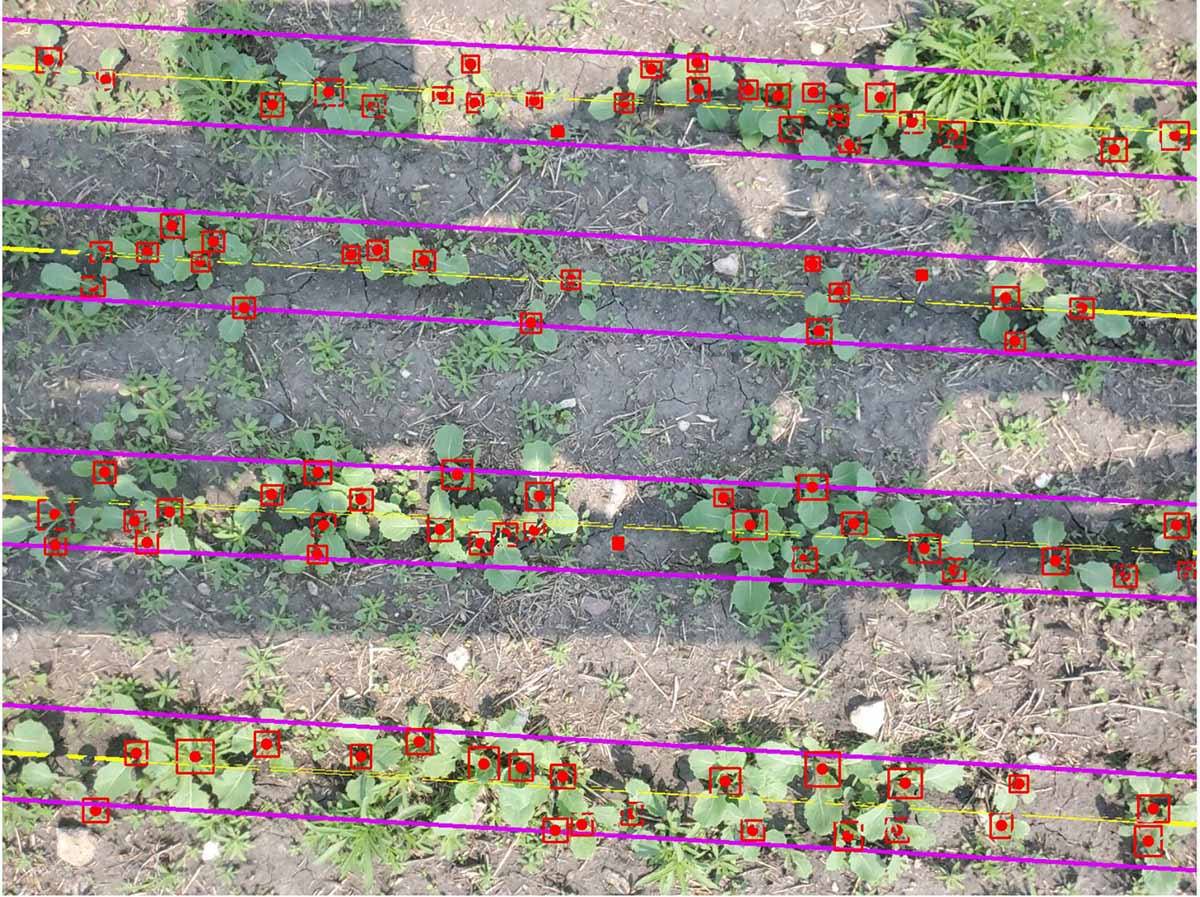
SWAT CAM mounts on sprayer booms and autonomously captures images every 60 feet. With no interface in the cab, there’s no action required by the farmer. The images are automatically uploaded to Croptimistic’s SWAT RECORDS software where machine learning models assess and segment crop versus weed data, creating an auto-generated map that summarizes these populations by SWAT zone. This allows farmers and agronomists to evaluate and adjust variable-rate seed/planting, fertilizer, or herbicide strategies to optimize crop establishment and develop SWAT-based prescriptions that target weed pressures across the field.
With the new plant stand count feature, the machine learning model within SWAT CAM analyzes each image and calculates individual plants per acre or per square foot, as well as the average measurements of plant spacing. The tool is available for corn, soybean, canola, and potatoes. More to come with the continuous future development.
“With SWAT CAM now having the ability to perform plant stand counts, it completely eliminates the need for human involvement in this labour-intensive process. It provides a 1000x higher resolution of counts and is completely objective and consistent.” says Derek Rude, VP of Research and Development at Croptimistic. “SWAT CAM uses constantly improving machine learning models to conduct these assessments. This is the pinnacle of observing what’s happening in the field.”
“This is a day we had marked on the calendar,” says Cory Willness, CEO of Croptimistic Technology. “We are very excited to be able to spend our time analyzing the profitability of seed applications rather than driving around for a month to capture a few observations. In an era of agriculture where greenhouse gas emissions are scrutinized and farmers need the best data possible to make decisions, this technology becomes a no-brainer. We can now collect 1000x the plant stand data with substantially lower GHG emissions and do it for the same cost as people with trucks.”
SWAT CAM pre-orders for 2024 made before December 14, 2023 will receive a 10 per cent discount off SRP of $3,950 CDN. That makes their hardware cost only $3,555 CDN per system, plus the subscription fee of $0.50/acre per year. All SWAT CAM orders must be made through a SWAT MAPS service provider and is only available to farmers who have mapped or intend to map their entire farms in the spring of 2024. To view a full list of service providers, please visit here.
About Croptimistic Technology Inc.:Croptimistic Technology Inc. is an international AgTech company providing SWAT MAPS, a turn-key variable rate process that prioritizes Soil, Water, and Topography factors of fields for the creation of management zones. Their SWAT RECORDS software powers the entire SWAT ECOSYSTEM of products, all of which are synced with the app for real-time viewing. Learn more about SWAT products and how you can leverage SWAT MAPS by visiting swatmaps.com.
-30-
For more information, contact:
Alexandra Blackwell
Marketing Coordinator
marketing@swatmaps.com