


Soil Potential
SWAT MAPS are so much more than a map. They’re part of an entire process that when used correctly, can unlock your soil and yield potential. Your SWAT MAPS service provider will help you execute this 6-step process so you can start unlocking your soil potential today. Here’s what you can expect when implementing and using SWAT MAPS on your farm.
Book A Demo
Not sure where to start? Reach out to our team directly and we'll help get the ball rolling.
1SWAT BOX
The first step is collecting the quality data needed to create your SWAT MAP. Using their SWAT BOX, a SWAT MAPS service provider will drive your field in 80 foot (24m) passes. Our patented SWAT BOX is an autonomous soil mapping system that can be mounted to many different vehicles, most commonly trucks, ATVs or other off-road vehicles, but also seeders or planters.
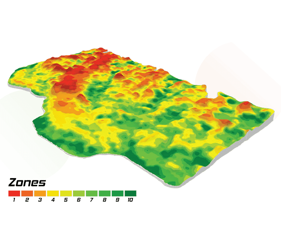
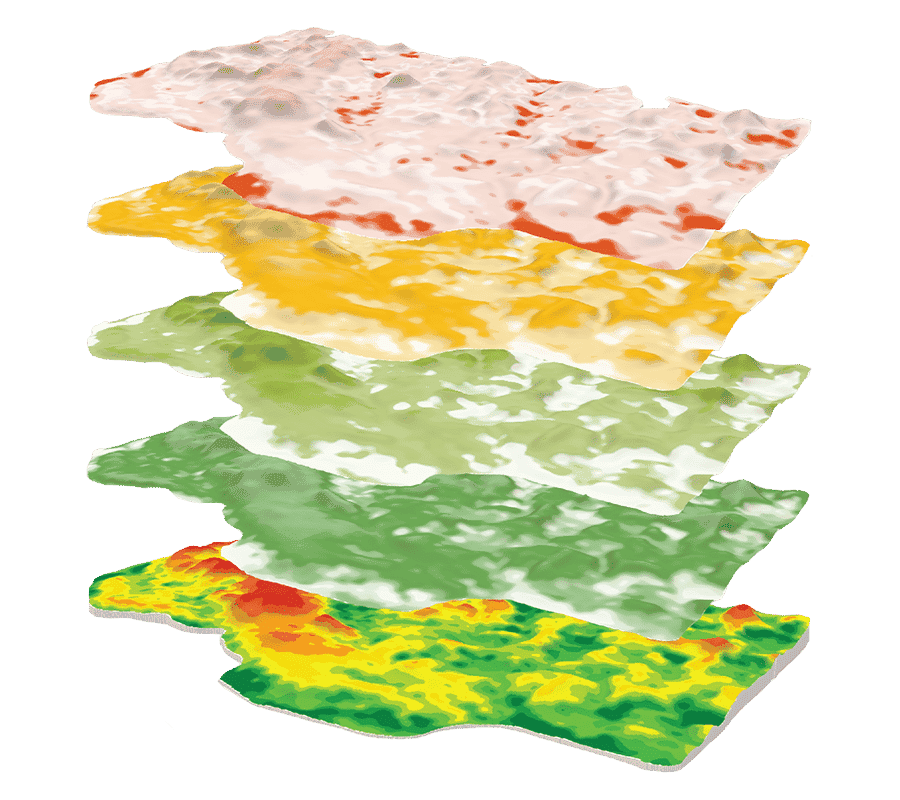
2SWAT MAPS
The raw data collected by the SWAT BOX is automatically uploaded and sent to our SWAT RECORDS software and is ready for our team of experts to analyze in order to create multiple SWAT MAPS options.
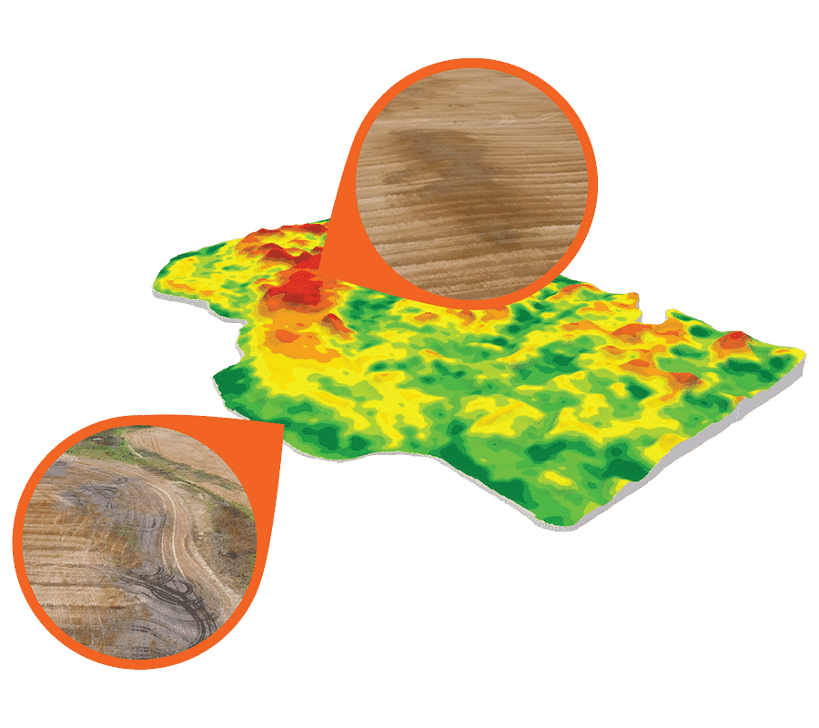
3Ground Truthing
With several potential SWAT MAPS created and uploaded to SWAT RECORDS, your service provider will return to the field to ground-truth the maps. This is an essential step in the process and it ensures your SWAT MAPS accurately depicts the soil and water variability in your field.
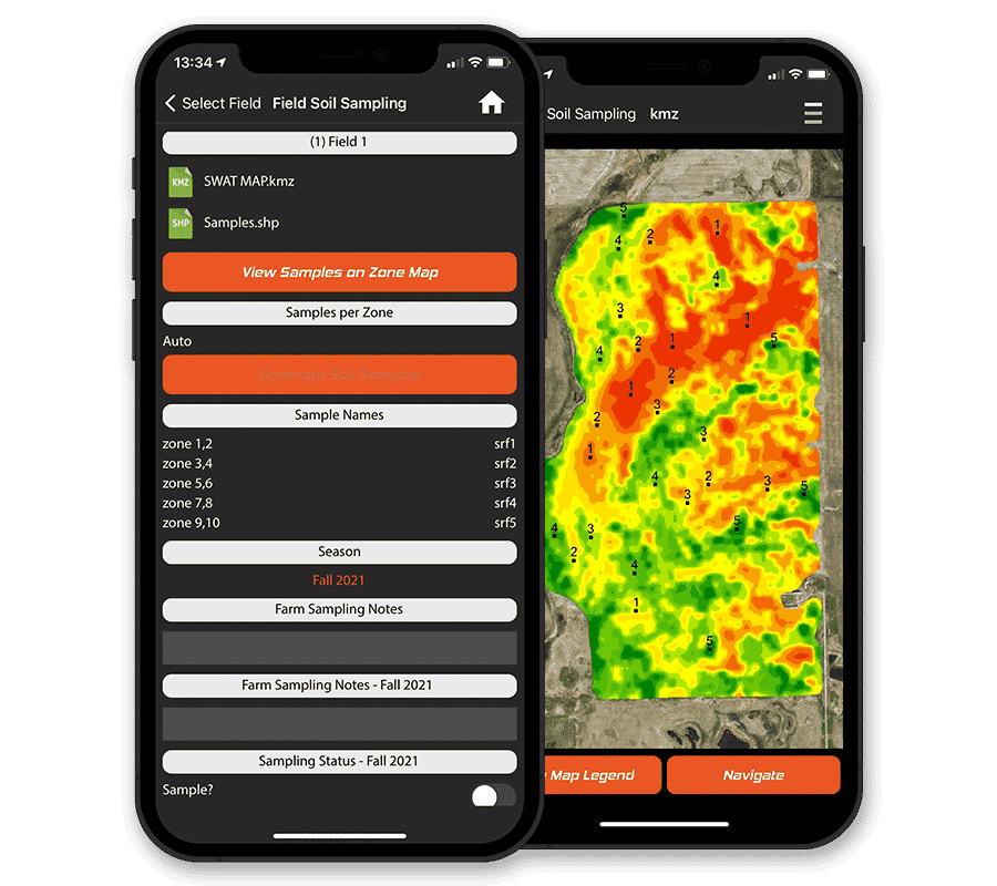
4Soil Sampling
Once your SWAT MAP is ground-truthed, it’s time to soil sample. Multiple cores are taken at 5 of the 10 SWAT zones, depending on field size, end goal, and the cost versus benefit of sampling intensity. Your soil sample results will be uploaded to SWAT RECORDS when they are complete.
Soil samples are taken every year after harvest at geo-referenced locations to track nutrient levels and ensure your prescriptions are meeting your yield targets, accounting for soil mineralization and any nutrient losses.
Soil samples are taken every year after harvest at geo-referenced locations to track nutrient levels and ensure your prescriptions are meeting your yield targets, accounting for soil mineralization and any nutrient losses.
5Soil Prescriptions
Your service provider will work with you to assess your operation and has the local agronomic expertise to make informed recommendations through SWAT RECORDS with the support of our team.
6Soil Analytics
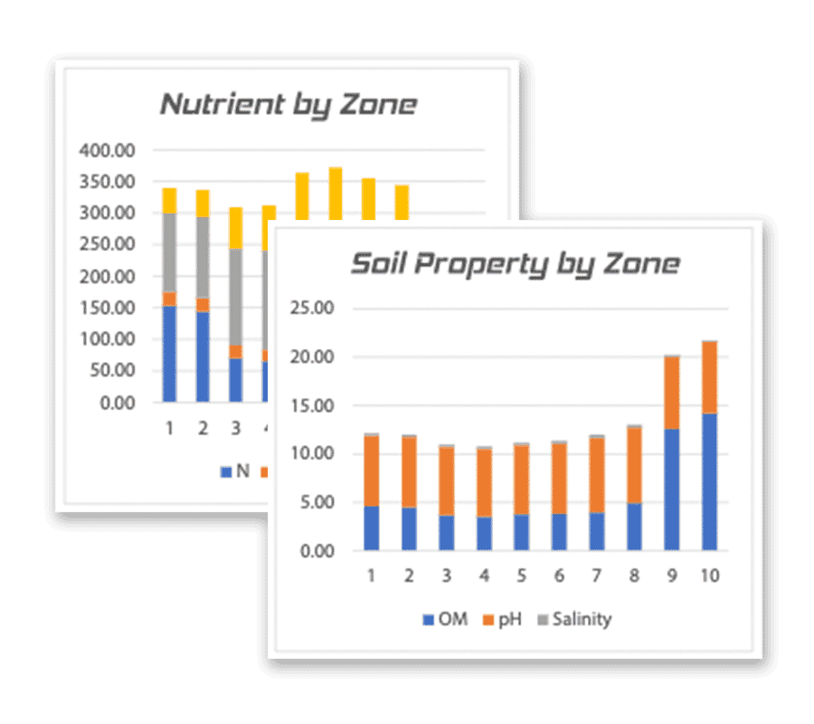
The last step in the soil potential process is to analyze nutrient, texture, and soil carbon data. Soil data can be connected to soil survey databases to assess varietal or hybrid crop responses to nutrients based on soil type.
Ready to Unlock Your Soil Potential?
Take your variable rate application to the next level with SWAT MAPS.
Book A Demo
Dive Deeper
Explore the ins-and-outs of SWAT MAPS and how you can level up your farm with our tools.


Croptimistic Technology Inc. is an international agriculture technology (AgTech) company. We began operating in 2018. Croptimistic is supported by a growing team of professionals who have dedicated their careers to developing the best soil mapping software and hardware in the world.
Copyright Croptimistic Technology Inc. © 2024 All Rights Reserved.
Privacy Policy
