0
$0.00
0 items

Farmers across many areas of Western Canada are all too familiar with the dry cycle of the past few years. Driving through these areas in mid summer, burnt up fields with “pothole” green depressions is a common sight. There are a lot of risks associated with farming, with Mother Nature being the biggest uncontrollable risk to every operation. A crop can only be as productive as the amount of water available to it. There are multiple ways to manage the risk of dry conditions which include the use of crop insurance, timing of seeding, weed management, stubble management, etc.
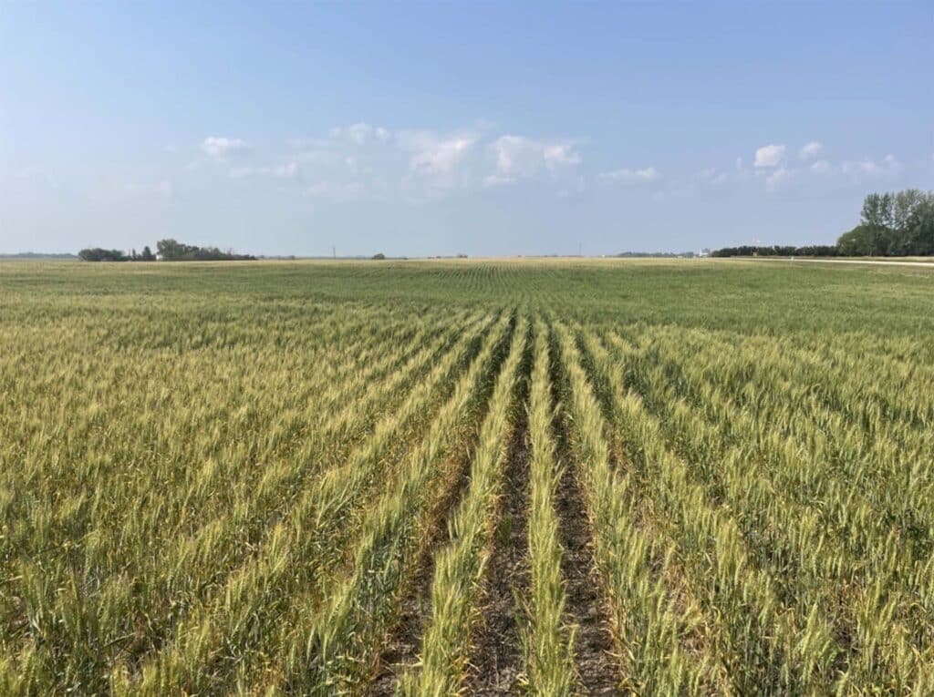
Figure 1: Photo of wheat crop in mid July of 2023. Hills are burnt up, mid-slopes are starting to turn, depressions are thick and green.
One mitigation approach could be switching up fertilizer strategies – the crop didn’t take up all fertilizer from last year and probably won’t use the same as usual, so hey let’s cut back. Easy. Done. Right? Yes… but what if you could take that one step further? What if the correct variable rate program can help you mitigate this risk on yet another dry year?
Using SWAT MAPS, you can allocate fertilizer based on the potential each area of the field has to further mitigate the risk of drought. The fertilizer on those hills and maybe even mid-slopes probably should be cut back but those “pothole” green depressions still have the potential to grow a decent crop in a dry year. SWAT MAPS can put your fertilizer where it counts.
Capturing the Right Variability in a VR Map
Although weather and dry conditions influence a crop and its yields, the right variable rate (VR) maps shouldn’t capture all field variability. After all, a hilltop that yields the same as a saline depression, but for different reasons, should not be treated the same. To create the correct base for a VR program, VR maps need to focus on soil potential and fertilizer-based response versus yield potential; Soil, Water, and Topography (SWAT) MAPS do this. SWAT MAPS separate fields into zones based on soil characteristics to help farmers allocate fertilizer where it is most needed.
.png)
Figure 2: SWAT MAPS zones
Flat rate vs VR Fertilizer
Using variable rate doesn’t necessarily mean cutting fertilizer rates by a certain percentage across an entire field, but VR through SWAT MAPS can still get a higher return on investment on clients applied nutrients. This is done by taking an existing fertilizer budget and reallocating that money to areas of the field that will respond more. In drought conditions, we are more aggressively cutting back fertilizer, particularly nitrogen, on low moisture, low potential areas. We are then taking that fertilizer and putting it in the areas with more moisture and therefore more response potential. This is seen in an example report below. Of course, we are also deciding on rates based off soil trends, mineralization potential, nutrient levels, farm logistics, etc. At the end of the day, you are spending money on fertilizer already; why not put that budget into the right spots?
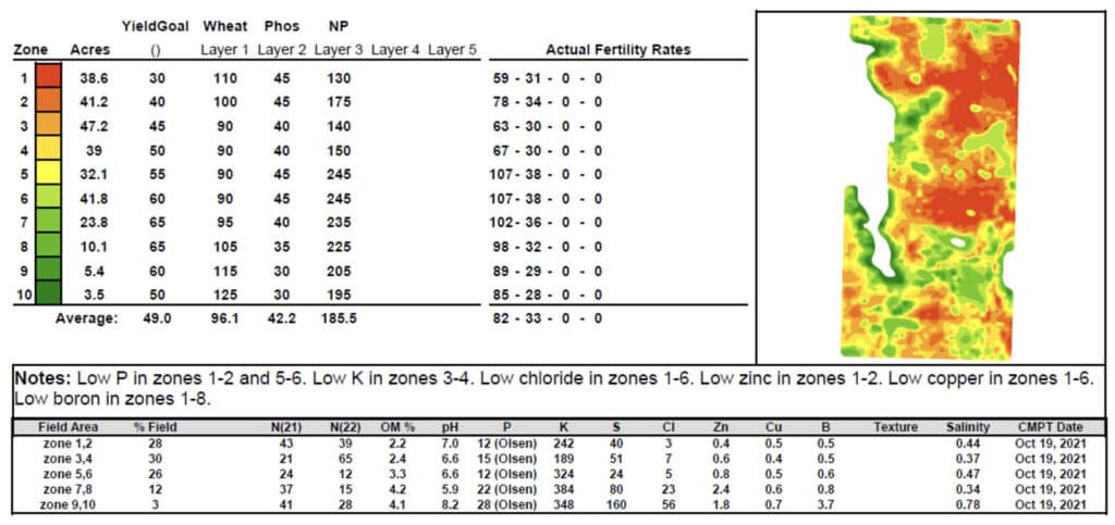
Figure 3: Example VR Report for Drought Conditions
Summary
Croptimistic takes pride on the many benefits and values of SWAT MAPS. In an area with ample moisture, even maturity might be the driving benefit for variable rate. But, in a dry area, risk management most likely is the overall VR goal. The hills are going to burn up quick and we don’t want to fertilize so your yield bearing areas do the same. Managing risk is done by reallocating fertilizer to areas of the field that have the best opportunity for higher yields and scaling back on areas of the field that do not. It is no coincidence that the “W” in SWAT MAPS stands for water. And after all, water is the biggest driver of yield and fertilizer response.
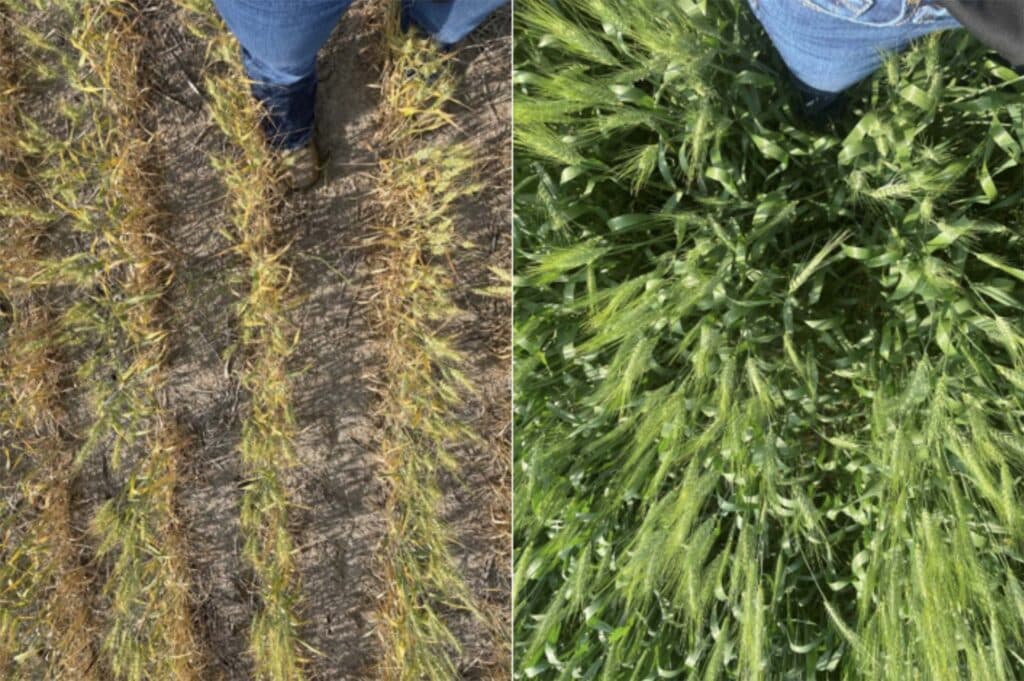
Figure 4: Same Field, Different SWAT zones. Mid July 2023.
Now is the time to plan your fertilizer strategy for the 2024 season.
Book your acres for spring by visiting our Book a Demo page.