


Patented high-resolution soil foundation maps
Soil, Water, and Topography (SWAT) MAPS are high-resolution soil foundation maps used to execute variable rate fertilizer, seed, soil amendment, pesticide, or precision water management. They are created using our patented process.
Praise from real farmers using SWAT MAPS on their farm
We have been using this technology on our farm for ten years. Best maps in the industry in my opinion. Very practical and logical approach to variable rate seed and fertilizer.
- Mark B.
Our whole farm has been mapped with SWAT MAPS. Our soil and available water changes in short distances on our land and the SWAT MAPS mapping system delivers high-definition maps representing the fields.
- Colin R.
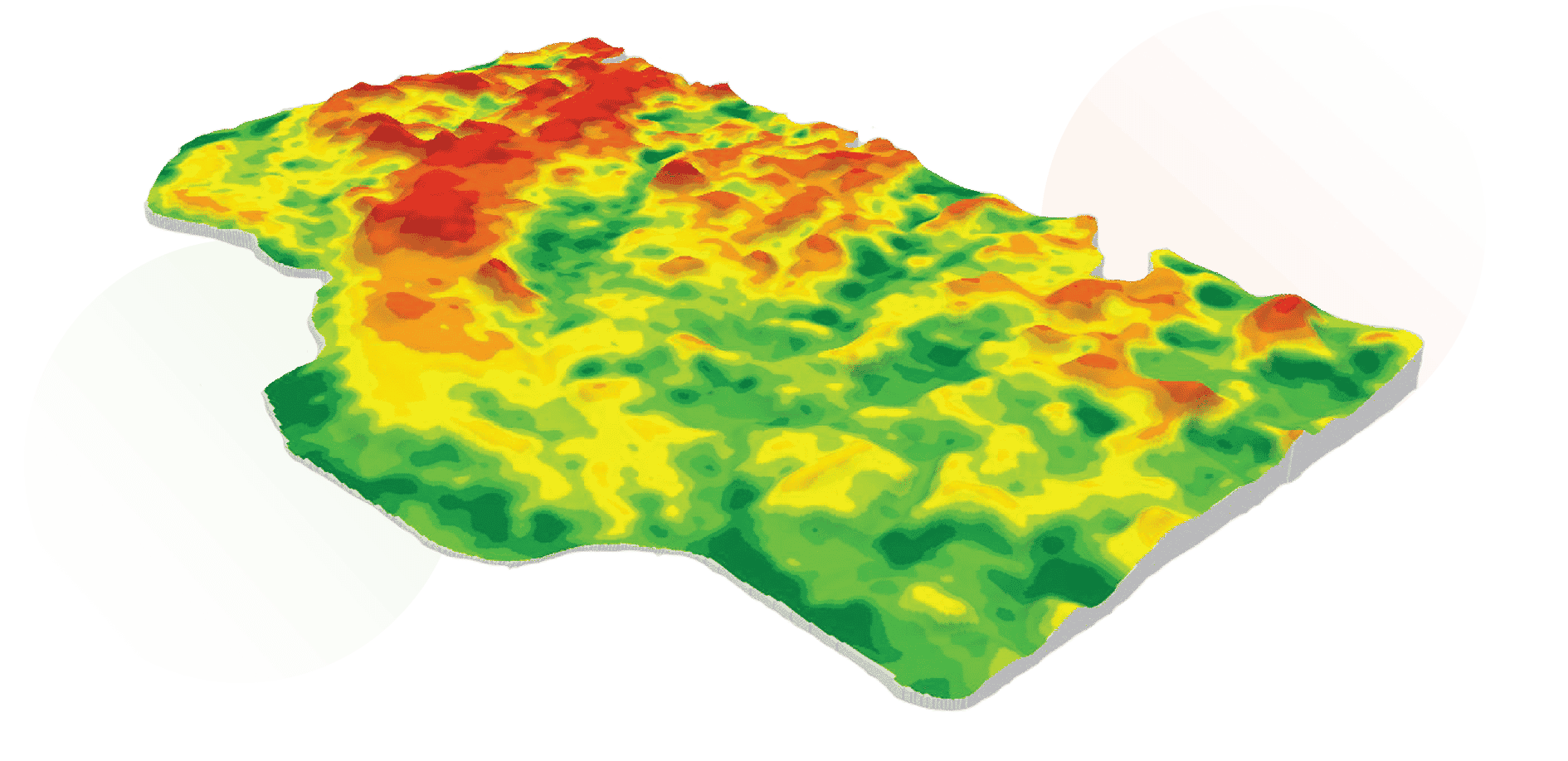
Let's Start From The Top
What are SWAT MAPS?
Soil, Water, and Topography (SWAT) MAPS are high-resolution soil foundation maps used to execute variable rate fertilizer, seed, soil amendment, pesticide, or precision water management. They are created using our patented process.
Soil
Factors such as soil texture, organic matter, topsoil depth, and salinity can all impact yield and fertilizer response.
Water
Water has the biggest influence on yield and fertilizer response. SWAT MAPS categorizes dry and wet areas in your field into ten different management zones.
Topography
Topography is described by landscape positions in a field (hilltops, mid-slopes, and depressions). Topography can influence soil moisture, erosion, organic matter levels, pH, and soil fertility levels.
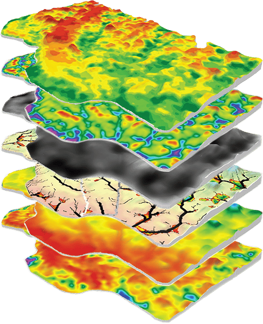
LEt's Unpack
The SWAT MAPS Layers
Topography
Topography is a detailed representation of the natural shapes and features in your field(s), including hills or knolls, mid-slopes, and depression areas that determine where water sheds or collects.
Organic Matter
Soil organic matter is the component of your soil that consists of plant and animal tissue at various stages of decomposition, substances that soil microbes synthesize. It is important for water holding capacity and nutrient supply in season.
Water Flow Paths
Water flow paths show the direction that water will flow in your field(s).
Elevation
Elevation maps show your field's distance above sea level. It is used to determine water flow paths, water accumulation, and as a base layer for a topography model.
Electrical Conductivity
Electrical conductivity (EC) is related to the variability of dissolved salts, moisture, and texture differences in your soil.
Get Into it
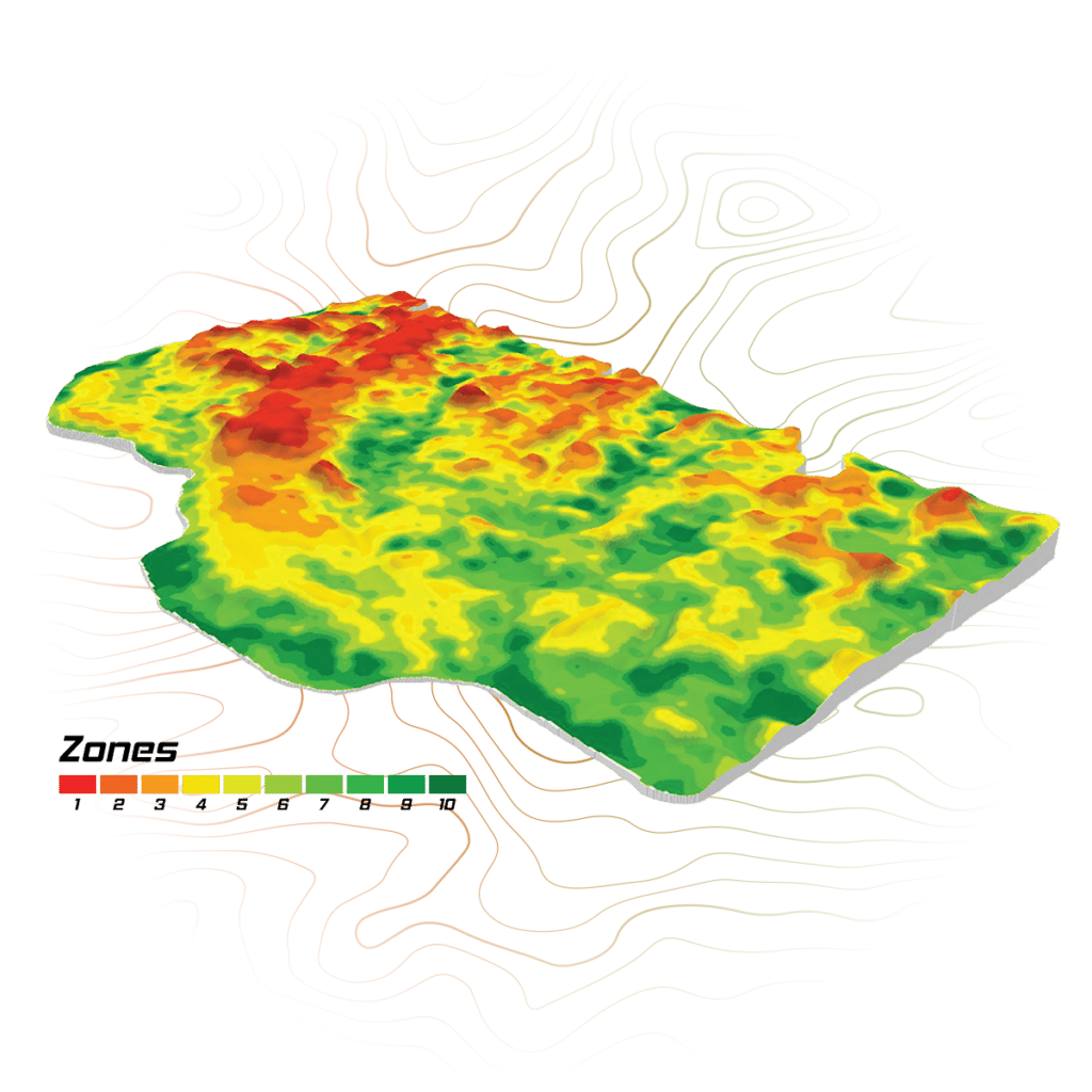
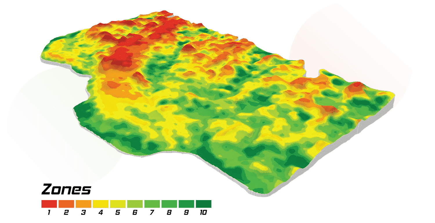
The SWAT Zones
All SWAT MAPS are made up of ten zones. Having 10 different zones accommodates variability in your field.
Hide All ZonesShow All Zones
Zones 1 & 2
Eroded knolls, hills, sandy soils, lower organic matter, dry areas (water shedding).
1
2
Zones 3 & 4
Shoulder slopes, upper slopes, water runs off.
3
4
Zones 5 & 6
Mid-slopes, flat areas, field average.
5
6
Zones 7 & 8
Toe slopes, lower flats.
7
8
Zones 9 & 10
Depressions, saline areas, higher clay content, peat/muck, high organic matter, wet (water collecting).
9
10
Zones 1 & 2
Eroded knolls, hills, sandy soils, lower organic matter, dry areas (water shedding).
1
2
Zones 3 & 4
Shoulder slopes, upper slopes, water runs off.
3
4
Zones 5 & 6
Mid-slopes, flat areas, field average.
5
6
Zones 7 & 8
Toe slopes, lower flats.
7
8
Zones 9 & 10
Depressions, saline areas, higher clay content, peaty, high organic matter, wet (water collecting).
9
10
The Benefits
Take advantage of SWAT MAPS on your farm to unlock these benefits and more:
Increase Your Return on Investment for Applied Nutrients
Based on the developed map, we can prescribe the optimum rates of nutrients where you’ll get the best response and decrease rates where soil nutrient supply is sufficient, excessive, or where the crop is unresponsive. The goal is to put nutrients where they have the highest potential for a return on investment.
Maximize Yield Potential
Variable rate seeding by zone is one way to maximize your yield potential. Increase seeding rates to increase plant competition with weeds. Achieve even emergence, maturity, and the full genetic potential of your hybrids by matching seeding rates to soil and water potential.
Reduce Lodging
Address specific nutrient balances in each zone to achieve targeted plant stands with variable rate seeding. Only use plant growth regulators in your high-risk zones.
Prevent Nitrogen Loss
SWAT MAPS identifies zones that are prone to nitrogen loss due to leaching or denitrification. Using nitrogen stabilizers in these zones can decrease the risk of nitrogen loss and your fertilizer costs when compared to a flat rate application.
Manage Salinity and Drainage
In saline areas, cut your nutrient application. You’re less likely to see a return on investment due to the limited yield potential. Compete with weeds and draw down excess water by increasing your seeding rate.
Manage Soil pH
Use variable rate prescriptions to apply lime, wood ash, or other soil amendments to manage soil pH and improve nutrient availability.
Improve Soil Applied Herbicide Performance
Soil-applied herbicide rates are based on soil properties, like organic matter, which are mapped and measured through the SWAT MAPS process. Using variable rate methods to apply the correct rate of herbicide in each zone helps maximize weed control. Target weed species that are problematic in certain zones.
Even Crop Staging, Maturity, and Minimize the Risk of Disease
Achieving a proper plant stand with variable rate seeding minimizes excessive tillers in cereal crops that delay maturity, or increases plant stands in areas with low survivability. In broadleaf crops and high producing areas, minimize the risk of diseases like white mould in soybeans or canola for instance, by decreasing seeding rates.
Wes Anderson, VP of Agronomy, gives an overview of what SWAT MAPS are, how to use them, and the process to make them.
More praise from actual farmers using SWAT MAPS on their farm
We farm a variety of soil types and topography usually in the same field and SWAT MAPS have really helped us improve plant stands and crop maturity across those fields. Crop grades, grain moisture, and straw management have all improved with VR seeding and fertility.”
- Rob D.
They have a really strong map. Dad said it best… "I have been going over that land for the last 40 years and I couldn’t have drawn it better myself."
- Jeff B.
Ready to get started with SWAT MAPS?

Croptimistic Technology Inc. is an international agriculture technology (AgTech) company. We began operating in 2018. Croptimistic is supported by a growing team of professionals who have dedicated their careers to developing the best soil mapping software and hardware in the world.
Copyright Croptimistic Technology Inc. © 2024 All Rights Reserved.
Privacy Policy