Side-Hill Seeps: An Electrical Conductivity Anomaly
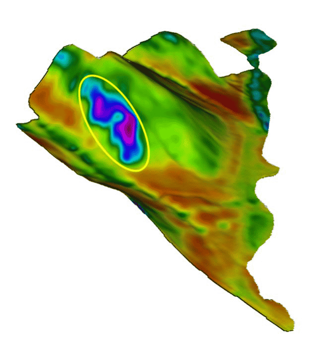
During the mapping season, we look at several electrical conductivity (EC) maps every day. Sometimes we come across something very interesting. Recently, while making maps for a field in eastern Nebraska, one of these unique situations was noticed.

The highest EC in this field is located on the side of a large hill. When I enquired with the local agronomist, he said that the farmer often gets stuck in this area because it is a side hill seep. Side hill seeps, sometimes referred to as “springs,” are quite common in various places in the prairies provinces as well. Usually high EC is found in depressions (salinity), but it can be found in other landscape positions as well.

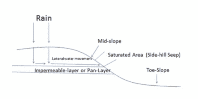
Side-hill seeps occur when there is an impermeable layer in the sub-soil. This doesn’t allow for water to normally infiltrate into the soil profile. If soil moisture accumulates to saturation, it finds an exit point, often on the side of a hill. The discharge water brings salts with it, which shows up as high EC. If there are no salts present, the discharge area is just a wet area, which can still have a negative effect on crop growth. EC can still be slightly elevated as compared to surrounding areas because of the excess soil moisture.
Management of side-hill seeps depends on the situation and the ability to identify the recharge area (where the water is originating). More information can be found on Management of Salt Affected Land in Saskatchewan., published by the Saskatchewan Ministry of Agriculture.
Summary
SWAT MAPS don’t make problem areas go away, but they provide a system for managing challenging parts of fields. This is accomplished by having the opportunity to apply varied seed and fertilizer rates to maximize potential and reduce risk.
Brad Dunnington
Senior SWAT MAPS Specialist
brad@croprecords.com


